River mouths and the coast
Water that travels down a catchment eventually enters tidal river mouths, lagoons/hāpua, estuaries, coastal bays or the open coast.
These environments support a wide variety of plants and animals and provide for a diverse range of human activities and values including recreation, commercial fishing, aquaculture, mahinga kai and tourism - all of which rely on natural processes facilitated by flow regimes and good water quality. These areas are also some of the most important areas to Ngāi Tahu.

Rangitata River mouth
Water quantity
River flow influences coastal waterbodies. It affects:
- sediment composition
- habitat structure and arrangement
- timing and frequency of river mouth openings
- environmental cues and passage for fish migration
- water quality (including nutrient concentrations, dissolved oxygen levels and water temperature)
- aquatic habitat availability
- streambed turnover.
The health and function of aquatic ecosystems and biodiversity may be compromised when the magnitude and variability of river flows are impacted by human-driven (e.g. abstraction) and climatic effects (e.g. drought).
The size, shape and movement of hāpua and estuaries, and the quality of their habitats, are impacted by reduced flows in hill-fed and alpine rivers. This is often compounded by artificial lagoon-level regulation to protect surrounding land.
Likewise, the timing, frequency and location of river mouth openings to the sea are affected by changes to the duration and magnitude of low and high river flow events.

Water quality
The water quality of estuaries, hāpua/coastal lagoons reflects the cumulative impacts of the entire catchment. Nutrient enrichment, fine sediment accumulation and toxic chemical inputs mean these environments can be severely impacted by their catchments.
Activities that occur either adjacent to, or within the coastal marine area can further reduce water quality. These activities include:
- wastewater and stormwater discharges
- on-site septic tanks
- historic landfills
- activities within ports
- dredging
- aquaculture
- forestry.
Nutrients in coastal lagoons and lakes
All seven of our monitored coastal lakes fail to meet the National Policy Statement for Freshwater Management (NPSFM) bottom line for total nitrogen concentrations, while five of the seven fail to meet the bottom line for total phosphorus.
Six of seven monitored coastal lakes do not meet the bottom line for chlorophyll-a (algae), meaning the ecological health of these lakes is impacted by high levels of phytoplankton growth. (See Figure 1)
NPSFM grades
A grade - Healthy and resilient ecological community
B grade - Slightly impacted ecological community
C grade - Moderately impacted ecological community
D grade - Degraded ecological community - failed to meet national bottom line
Figure 1: Chlorophyll-a (algae) in monitored lakes in Waitaha
Sedimentation
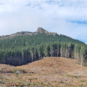
Moepuku forest in Whakaraupo
Sediment is transported down streams, rivers or stormwater pipes into lagoons, estuaries and coastal bays where fine sediment can accumulate. This can lead to an increase in 'muddiness' which can adversely affect the habitat of aquatic species (See Figure 2).
Fine sediment that doesn't settle can remain in suspension in the open coastal environment. Suspended sediments reduce water clarity affecting photosynthesis of plants, clogging the gills of fish and the feeding apparatus of shellfish, and reducing the ability of predators to seek prey.
High suspended sediment concentrations are known to occur in the Waitaha Bight, derived from alpine-fed rivers (Rakaia, Rangitata and Hakatere/Ashburton rivers) during major flooding events.
Sediment can also enter rivers and the sea directly through runoff when harvesting forestry. This is a particular concern for Lyttelton harbour/Whakaraupō.
Sea level rise, as a result of climate change, is likely to lead to greater sedimentation from coastal erosion.
Figure 2: Sediment muddiness at an estuary
Figure 2
Nutrients in estuaries and coastal waters
Nutrient enrichment is known to occur in estuaries and coastal waters including the mouth of the Waimakariri River, within Pegasus Bay, between the Rakaia and Rangitata rivers, and within the Avon-Heathcote Estuary/Ihutai.
This is likely influenced by the nutrients discharged by the major rivers.
Excess nutrients in estuaries can lead to macro algae blooms (e.g. sea lettuce) such as that seen in the Avon-Heathcote/Ihutai estuary (see Figure 3).
 covers the bed of the Avon-Heathcote Estuary/Ihutai.")
Figure 3: Nuisance macroalgae growth (Ulva sp.) covers the bed of the Avon-Heathcote Estuary/Ihutai.
Chlorophyll-a concentrations at coastal and estuarine sites
More than three quarters of sites monitored in coastal waters had an increasing trend in chlorophyll-a concentration from 2013 to 2020 (see Figure 4).
Marine heatwaves have occurred in Waitaha coastal waters almost annually since 2015. Warmer waters may lead to increased algae production, providing sufficient nutrients are available.
")
Chlorophyll-a concentrations at coastal and estuarine sites between January 2013 and December 2020. (Figure 4)
Recreational swimming spots
Waitaha is fortunate to have a long coastline that boasts many popular swimming spots.
Every year, between December and early March, we measure their suitability for recreation. Most estuarine and coastal sites are suitable for contact recreation most of the summertime, with coastal sites more likely to be graded good or very good. (See Figure 5)
Figure 5: Highlights the proportion of summertime monitoring sites that are suitable for contact recreation based on microbial data (E. coli measurements)
Current actions or approach
How we manage water quantity and quality in our river mouths and at the coast
Water quantity is managed through flow and allocation regimes set in the land and freshwater planning framework. It includes environmental flow limits (where taking water must stop) and allocation limits (a maximum amount of water that may be abstracted).
Despite this, many of our river mouths and estuarine environments are under stress due to the amount of surface and groundwater abstracted for use and lower flows that may result from less rainfall. This means that our rivers often don't have enough flow to force river mouth openings on their own. Occasionally, we open them artificially, using diggers to reduce the build-up of water and sediment and the flood risk to surrounding land.
Water quality is managed largely through the Land and Water Regional Plan (LWRP) and the Canterbury Regional Coastal Environment Plan (CRCEP) (PDF file, 6.98MB). The LWRP specifies water quality targets and limits and managed land use inputs and discharges to land and water.
The CRCEP manages, through resource consent processes, point source discharges into the coastal marine area. Water quality in coastal lagoons is factored in when determining these nutrient limits and the effects.