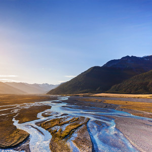
Alpine and hill country
Water falls on the alpine and hill country as rain and snow. This water then flows down catchments, forming lakes, wetlands and rivers, and percolating into the groundwater system. Rainfall and snow melt are key drivers of flow in our alpine and hill-fed rivers however, this can be highly variable through the seasons and between years.
The alpine and hill country is the main source of freshwater for all of Canterbury/Waitaha, and issues affecting water quantity and quality in these inland catchment areas are felt across the plains to the coast.
Here are the current issues facing water quantity and water quality in the alpine and hill country of Waitaha.
Issue: Water quantity
Precipitation is the main driver of lake levels, river flows and groundwater levels. A single rain event can quickly change the state of a river, while groundwater levels generally show a delayed response.
Climate change is expected to bring increased variations in temperature and precipitation (including rainfall and snowfall), which will likely also impact on groundwater recharge, groundwater levels, spring flows and demand for water use.
Human-induced changes also affect river flow, lake and groundwater levels in Waitaha. These changes include water abstraction, diversions, dams, drainage, discharges and changes in irrigation and flood management practices. Each of these can, in turn, impact ecosystem health throughout the catchment.
Some examples of activity or modifications that impact water quantity are outlined:
Hydroelectric dams
Hydroelectric dams and schemes in Waitaha play a significant role in the country's electricity generation network. They often require large modification to the natural environment, both during construction and as an ongoing effect of the operation of these dams.
Hydroelectric dams influence river flows by storing water and releasing it to meet electricity demand. Rivers with large hydroelectric dams in their catchments can have flow regimes.
Wetlands
Drainage and development of wetlands reduces natural water storage capacity in the alpine and hill country, with downstream effects.
Plantation Forestry
Plantation Forestry is likely to increase in Waitaha over time. This can affect the flow regime in rivers; water storage and retention in surrounding soils; and water levels in receiving environments such as wetlands and lakes.
It also changes the amount and timing of evapotranspiration, which could lead to the isolation and loss of freshwater habitats. Sixty-two catchments have been identified as flow-sensitive catchments (see Figure 1). However, other catchments not currently identified as flow-sensitive could potentially be at risk from the adverse effects of afforestation.
Issue: Water quality
Water quality and aquatic ecosystem health in our inland alpine and hill-fed catchments is generally very good. However, intensification of agricultural and residential land uses in inland basin areas has led to impacts on these sensitive environments such as ecosystem damage in waterways and wetlands.
These high-country ecosystems are highly sensitive to small increases in nutrient concentrations and include Mackenzie Basin/Te Manahuna), inland Ashburton/Ōtūwharekai and inland Waimakariri basins.
The Quantitative Macroinvertebrate Community Index (QMCI) is a measure of abundance of pollution-tolerant sensitive invertebrates living in a river bed. A higher score means a greater abundance of pollution-sensitive taxa (e.g. stoneflies and mayflies) relative to pollution-tolerant taxa (e.g. snails and worms) and is indicative of a healthy stream ecosystem.
Figure 2: Quantitative Macroinvertebrate Community Index (QMCI) in monitored rivers in Waitaha
Water quality in our high country lakes
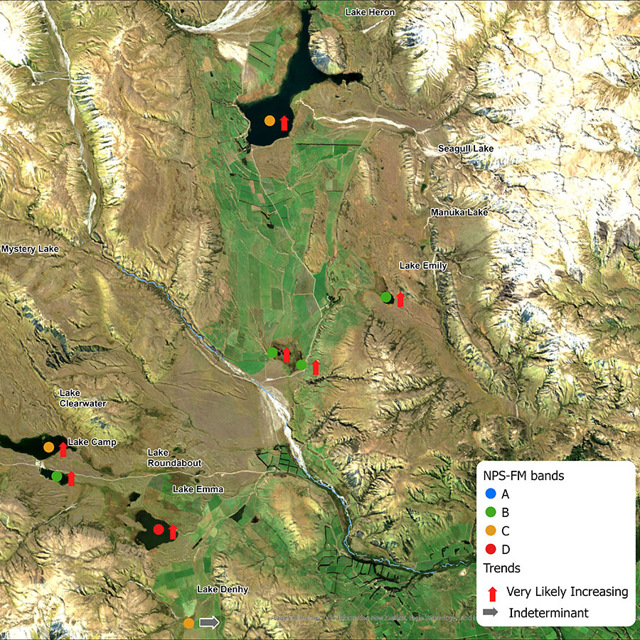
In our high country lakes, 35 percent of monitored sites retain healthy and resilient ecological communities, while 44 percent may be slightly impacted by additional algal growth (indicated by chlorophyll-a) - a green pigment found in most plants, including algae.
Lake Emma is our only high country lake that fails to meet the national bottom line for chlorophyll-a at its monitoring site.
High country lake environments are very sensitive to changes in nutrient loads (such as nitrogen and phosphorus), which in turn affect how much phytoplankton grows. Even small changes in land use around these lakes can cause significant changes to phytoplankton growth and ultimately ecosystem degradation. Once these changes occur, they are very difficult, and sometimes impossible, to reverse.
We are seeing signs of degradation in a number of high-country lakes. For example, six of the seven lakes we monitor in Ashburton Lakes/ Ōtūwharekai have increasing concentrations of chlorophyll-a which indicates increasing nutrient inputs.
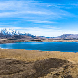
Lake Heron, Ōtūwharekai
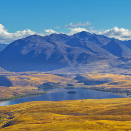
Lake Alexandrina, Mackenzie Basin
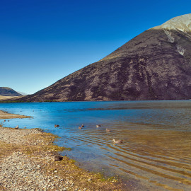
Lake Pearson, Craigieburn Forest
Current actions and approach
The hill and high country of Waitaha is among the least developed land, with some of the most sensitive ecosystems in the region.
Several targeted management initiatives have been put in place to protect the high natural values in these areas. At the central government level, there are three Water Conservation Orders (WCOs) applying to alpine waterways in Waitaha; namely, the Ahuriri River, Rangitata River, and the Rakaia River. These pieces of legislation protect the values of the waterways. All Regional Policy Statements and regional and district plans must be consistent with a WCO.
At a regional council level, there are statutory controls on activities impacting hill and high country waterways. These range from the identification and protection of catchments which are highly sensitive to flow changes and water yield effects associated with plantation forestry, through to preventing damming in the upper reaches of alpine rivers such as the Hurunui.
There are also several non-statutory initiatives undertaken in these areas, such as Project Ōtūwharekai. In 2019, at the request of Te Rūnanga o Arowhenua, a working group was formed to address concerns about the health of the Ashburton Lakes/Ōtūwharekai. The working group is made up of rūnanga (Te Rūnanga o Arowhenua, Te Ngāi Tūāhuriri Rūnanga and Te Taumutu Rūnanga), councils, government agencies, Fish & Game, and those farming in the area. The group has conducted water quality investigations, is working with landowners to develop a lake-by-lake land use risk analysis, and rūnanga partners are leading work to understand the changing environment through a mātauranga lens.


