River works in Kaikōura
It’s been a busy time since the Canterbury region-wide floods, with lots of calls from the community about river works. Kaikōura rivers officer, Mike Gilliver provides an update on flooding in Kaikōura, and how river works are funded.
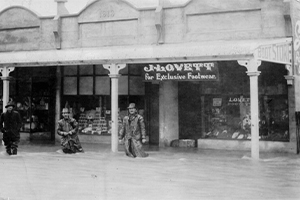
Floodwater flowing through Kaikōura township - September 1954.
Kaikōura – a history of flooding
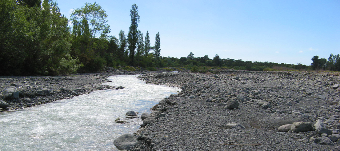
Unpredictable floods have been part of life in the Kaikōura district since records began. Kaikōura township lies on the coastal edge of the floodplain at the mouth of Waikōau/Lyell Creek and has experienced many breakouts from the Kowhai River.
Council records date back to the great flood of 1868, when a violent storm swept across the country, wrecking 12 ships, and causing flash floods. The first flood protection schemes began in response to this event, and the Kaikōura River Board was formed in 1877.
The Kaikōura River Rating District

Across the region Environment Canterbury manages 58 river and drainage schemes to prevent damage or danger to nearby communities, keeping people and properties safe.
Kaikōura’s rivers and drainage schemes cover an area of about 65km² protecting a considerable population and assets worth about $1B on the floodplain including rural farmland, residential areas, the town business and shopping area, community facilities, and public utilities such as roads, bridges, and three waters infrastructure.
Within this area we maintain 34km of stopbanks and a 450m length of Lyell Creek floodwall, and undertake works on waterways including Harnetts Creek, the Waimangarara River, Lukes Creek, Waikōau/Lyell Creek, Middle Creek, Floodgate Creek, the Kowhai River, Ewelme Stream/Stoney Creek, and Elms Stream.
Working with the community
In Canterbury’s 25 largest river rating districts, including Kaikōura, we work with river rating district liaison committees, whose members are volunteer community representatives.
At annual meetings, committee members let the Council know their views on the proposed flood protection works and rates for the following year.
Flood protection infrastructure such as stopbanks and groynes need ongoing maintenance and we also undertake planting and weed control, remove gravel, place rock and occasionally open river mouths to the sea.
Our rivers are dynamic so there’s always plenty of work to do!
How this work is funded
The decision about what flood protection works are carried out and the level of protection they can provide needs to be balanced against a financial contribution that’s sustainable for the landowners receiving the benefit of flood protection works.
The owners of properties in the river rating district pay a mixture of targeted, works and services and general rates to cover the cost of flood protection and drainage works. Rates are based on the cost of the works needed to provide the agreed levels of flood protection and calculated as a percentage of the property value.
Your rates notice will tell you if you are a ratepayer of a river rating district or you can check by searching for your address.
Work outside rating districts
If your property is outside a river rating district, we can sometimes give flood protection advice, but we don’t currently fund flood protection works in these areas.
We don’t repair flood damaged roads, fords, road culverts or bridges or clear debris or obstructions from bridges and culverts, that’s the responsibility of the roading authority (Waka Kotahi NZ Transport Authority) the local council or private landowners.
If you need more information about flood protection in your area, give our customer services officer, Rachel, a call on 03 319 5781.