Ohau – Pūkaki – Tākapo Rivers track damage
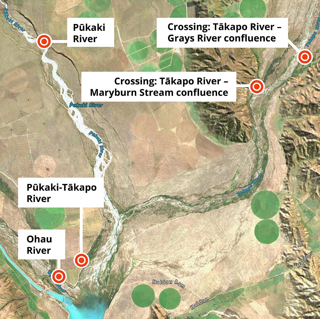
Several tracks between the townships of Twizel and Tekapo are damaged following severe weather throughout July and August. Track users are urged to use alternate routes or exercise extreme caution.
- Ohau River: Damaged track on the eastern side of the Ohau River, between the Twizel and Tākapo/Tekapo Rivers.
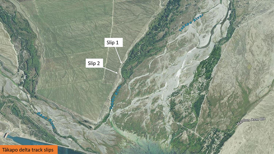
- Tākapo River: Two significant landslips on the main access track along the southern end of the Tākapo River (see further information below).
- Pūkaki River: Significant scouring to the access track along the eastern side of the Pūkaki River may mean this road gets closed.
- Maryburn Stream – Tākapo River confluence: Damage to the concrete ford crossing at the Maryburn Stream – Tākapo River confluence rendering the crossing impassable. The Maryburn is carrying higher than normal flows.
- Grays River – Tākapo River confluence: Damage to the concrete form ford crossing at the Grays River – Tākapo River confluence. Grays River is carrying higher than normal flows.
A main access track along the Pūkaki - Tākapo/Tekapo River is closed following significant landslips.
The track is near the delta of the Ōhau, Waitaki and Pūkaki - Tākapo rivers, and will be closed indefinitely.
Semi-permanent deterrents are placed on either side of the slips.
Our rivers team said many people use the track as a shortcut from the Haldon Arm campground to Twizel and the surrounding areas during the high-country fishing season.
People may still be able to cross at the existing 4WD-only track directly out from the Haldon Arm campground below the power pylons, however, it is important to understand that, after the recent flooding and heavy rain, the condition of that track isn’t known. Caution is advised.
People travelling to or from Twizel from the Haldon Arm Campground would be best to go via Haldon Road and Dog Kennel Corner onto SH8.
Recreational users or contractors should access the true right bank of the Pūkaki - Tākapo River from the Haldon Arm Campground or from the Tākapo power station end.
There is track damage near the Pūkaki spillway that would otherwise allow access.
The two landslips were likely caused by ground saturation from heavy rain throughout July and August.
The track is within the Upper Waitaki river rating district and is widely used during fishing and camping seasons.


