Rangitata River – why did it flood and what happens now?
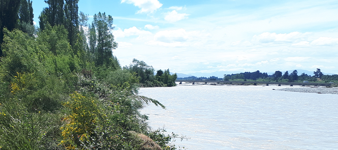
The flooding of the Rangitata River in early December got the nation’s attention when it disconnected State Highway One for three days.
Although the flooding and road closures were high profile, the cause of the flooding and how the break-outs happened might not be so well known.
Our river engineering and natural hazards experts have answered some of the top questions people had about the December flood event.
We will continue to use this page to provide updates on the ongoing recovery process.
Update February 2020
The first priority was to stop the outflow of floodwaters from the river onto the adjacent floodplain and over key roads.
This was largely completed by mid-January thanks to a massive effort from machinery operators, contractors and key staff from several organisations including Environment Canterbury, District Councils and various utilities.
The work involved was all ‘in-river’ and primarily consisted of gravel bunds and channel diversions.
Work has now largely paused for a time while agencies agree on future works to take place and what needs to happen to get the scheme back up to pre-event standard.
These works, which may take 12-24 months, will likely focus on reinstating banks and vegetated berms which are crucial in erosion reduction and provide some limited protection against overflows.
How to fund this work is being worked through with key agencies now and may cost in the order of $1 million.
Beyond this, there will be conversations with a wide range of partners and stakeholders on what the future of the river and any changes to the standard of protection may look like.
This is a long term conversation and will require wide consultation and investigation.

Mosaic images
Environment Canterbury's team of scientists and engineers captured images of the south branch of the Rangitata River during the December 2019 flooding.
Several hundred vertical photos were taken on 9 December 2019.
These were combined together using specialist software and a technique called “mosaicing” to create a single image of the river in flood.
It is important to note that due to some technical constraints, the images are not considered to be 100% accurate in regard to location.
See a side-by-side comparison of the ‘before flooding’ and ‘during flooding’ aerial images on Canterbury Maps.
Frequently asked questions
The flooding experienced along the Rangitata River in December was the culmination of an extreme weather event across the West Coast and Canterbury.
In the Rangitata catchment it caused six days of heavy rain and three high river flows that peaked at a massive 2307 cumecs (cubic metres per second).
This is 35 times more flow than usual!
During the third high flow – on 8 December – the flow stayed over 2000 cumecs for 10 hours – an extremely intense flow for the river.
The long period of continual rain in the headwaters and very high river flows were the key factors that led to the extensive damage to river protection works and led to flooding onto the road and farmland.
Different flow patterns and major breakouts from the river caused most of the disruption and damage – including the closure of the two key roads and bridges across the river.
Rangitata south branch
Before the river peaked, the main branch of the Rangitata River broke into the entry point to the usually dry south branch river channel about 4.5 km above State Highway One.
The south branch is a known and mapped floodway but there hadn’t been a significant flow down this channel for 24 years.
The south branch temporarily became the dominant river flow channel as the main river flow dropped - meaning there was more water flowing in the south branch than the usual Rangitata main branch.
Significant flows persisted down the south branch channel right up until Saturday 14 December, when flows were diverted back into the main channel.
South branch breakouts
Floodwaters overtopped this south branch channel approximately 2 km upstream of State Highway One.
These overflows caused the flooding on State Highway 79, State Highway One and in the Rangitata Village.
Railway line and State Highway 1 flooding from main branch
Floodwaters also broke out of the main river just upstream of the railway line, crossed State Highway 1 and flowed into the Rangitata Island area.
This is the main flow that stopped traffic on the highway.
There were other breakouts below State Highway One from both the main and south branch river channels.
These exacerbated flooding of farmland on Rangitata Island and on both sides of the south branch.
Arundel breakout
In addition, a large breakout occurred 2 km upstream of Arundel township.
This flooded the township and Geraldine-Arundel Road, closing access to the Arundel Bridge.
The overflow was contained downstream by nearby irrigation pond infrastructure.
Excess flows were then discharged via pond weirs back to the main river and did not extend further over farmland.
The flood event was beyond what the Rangitata flood protection scheme was designed to withstand (about 1500 cumecs).
The river protection scheme, primarily funded by those farmers and landowners who benefit from a level of flood protection, is discussed annually at a rating district committee meeting.
The recommendations then go to Council for consideration in the Annual Plan process.
There are several stages to recovery.
The first priority was to stop the outflow of floodwaters from the river onto the adjacent floodplain and over key roads.
This has now been completed thanks to a massive effort from machinery operators, contractors and key staff from several organisations including Environment Canterbury, Timaru District Council, and NZTA.
The next stage is in channel works and realignment of main flow channels to ease the pressure being put on key locations at risk of future breakouts.
This work is ongoing now and, while there will be constant improvements, will take weeks and maybe even months.
The last part of the puzzle is reinstating banks and the vegetated berms, which are crucial in erosion reduction and in providing some limited protection against overflows.
Hundreds, if not thousands, of established trees were lost and this is something that will take years to fully recover.
The south branch is a mapped and known floodway.
This event has shown that break outs can occur from the south branch channel during flood flows, which impact people, property, and infrastructure.
If you need to respond to an emergency (like a flood), you should contact Customer Services to discuss what earthworks you need to do.
Make sure Customer Services knows you need to respond urgently and they will put you in contact with the correct team (Resource Management Technical Leads).
In response to an emergency, you may be able to undertake some works without resource consent to protect life and property if it is reasonable in the circumstances and mitigated afterward.
If possible, you should discuss this with us prior to starting so they can agree to the work and make sure you are aware of all the provisions.
Ideally, you will send an explanation and photos via email to help inform their decision.
If you need to respond prior to the next normal business day contact our after-hours staff on 0800 765 588 (24 hours).